Maps are the best tool to view the arrangement of things on the Earth's surface. Maps of various kinds--road maps, political maps, land use maps & maps of the world--serve many different purposes.
Topographic Maps
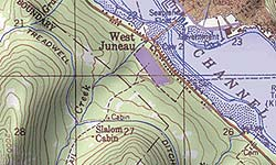
 Topographic maps are widely used. The use contour lines to portray the shape & elevation of the land. Topographic maps show the three-dimensional ups & downs of the terrain on a 2D surface.
Topographic maps usually portray both natural & manmade features. They show & name works of nature, including mountains, valleys, plains, lakes, rivers & vegetation. They also identify man-made things such as roads, boundaries, transmission lines & buildings.
The wide range of information provided by topographic maps makes them useful. Topographic maps are used for engineering, energy exploration, natural resource conservation, environmental management, public- works design, commercial & residential planning & outdoor activities like hiking, camping & fishing.
 Topographic maps are widely used. The use contour lines to portray the shape & elevation of the land. Topographic maps show the three-dimensional ups & downs of the terrain on a 2D surface.